End Game (Game of code 2020) - Show historical events in the map
Published on October 11, 2020
Slava Viacheslav
2 reuses
Informations
- Type
- Application
- Topic
- Others
- ID
- 5f82a9fe7a9df18136857310
Publication
Embed
Permalink
Description
We would like to present project that we did during this hackaton.
The project uses data from Open Data Platform and then processes it with help of Machine Learning - AI.
The project is Web and Android application that will boost tourism in Luxembourg in times of covid pandemic times.
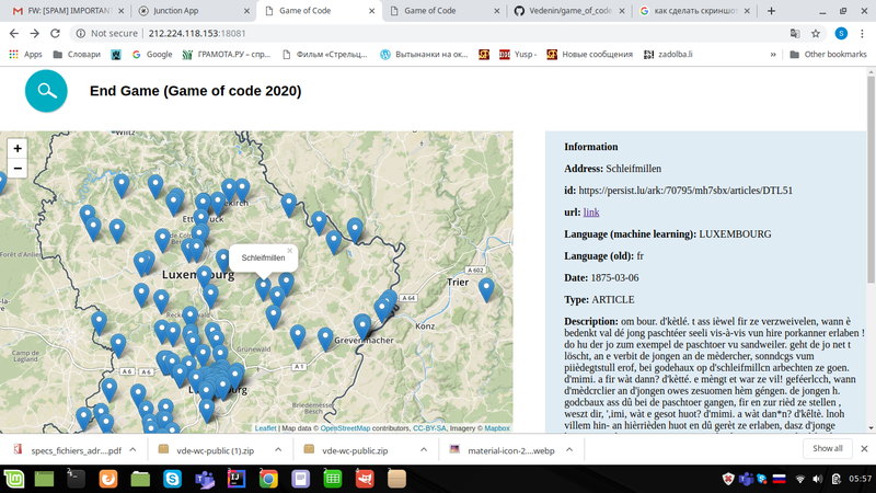
We processed History data from OpenData and extracted correct address of all the Historical events.
Then after obtaining addresses we made app for TOURISM that that has path all over the Luxembourg map with historical news.
Now you don’t need to go abroad and you can explore Luxembourg by travelling and understanding the history of the place.
Also we thought a lot about matters of mobility and healthcare.
Vulnerable groups of people need help more then ever during this pandemic times!
So we made Application that shows with alongside with Map a way to make the best and quickest route home during your trip!
If person starts to feel tired or ill and needs some help or assistance - he can order taxi in one click or check the nearest PUBLIC transport stops in one click.
Vulnerable/elderly groups of people might have problem with VISION - that why we make TEXT - TO - SPEECH processing that will read local history news .
Also Text-To-Speech will read aloud public transport sheducle.
Used datasets 6
Discussion between the owner and the community about this reuse.
More reuses
Discover more reuses.
-
Inondations.lu widget shown in geoportail
Visualization
Published on June 24, 2022 by Administration de la gestion de l'eau
-
-
Safe Crossing Project - Potentially unsafe pedestrian…
Application
Published on May 27, 2022 by Zentrum fir Urban Gerechtegkeet
-